A highlight of the second walk of the year, the first since autumn, is that everything feels much easier. It always surprises me how quickly we regain our base fitness after periods of inactivity. This walk is ideal for building up the confidence and strength required for ambitious plans later in the year. We walked around 15km, but it is easy to cut this walk in half.
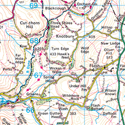
Unlike most users of Gradbach car park, who will head south-west to see Lud’s Church and the Roaches, we begin our journey heading north-east alongside the River Dane. Joining the road and bearing right, the footpath leads us up a short steep hill through a farm and into a procession of fields 500m in length, where horses and ponies graze under their winter coats. A gentle 70m climb brought us to a not-so-obvious crossroads. The ground here was frozen hard and was pocked with deep puddles whose ice caps were covered with a dusting of snow. This made them hard to distinguish from the more solid ground, and so we tried our best to keep dry feet. We turned left and moved towards the mouth of the valley that carries the River Dane away from our first landmark, Three Shires Head.
The path alongside the River Dane sits under a thicket of Rowan that line the east side of the valley. As we approach our destination, the sides become steeper and the views more vivid until, rounding a corner we see a small waterfall that leads up to Panniers Pool. The pool is a natural widening of the River Dane that sits just before the packhorse bridge. If the weather were a little warmer it would make an excellent place to take a dip, however in this snow dusted January morning we had the place to ourselves and were instead able to enjoy stepping across the dry rocks to the centre of the river.
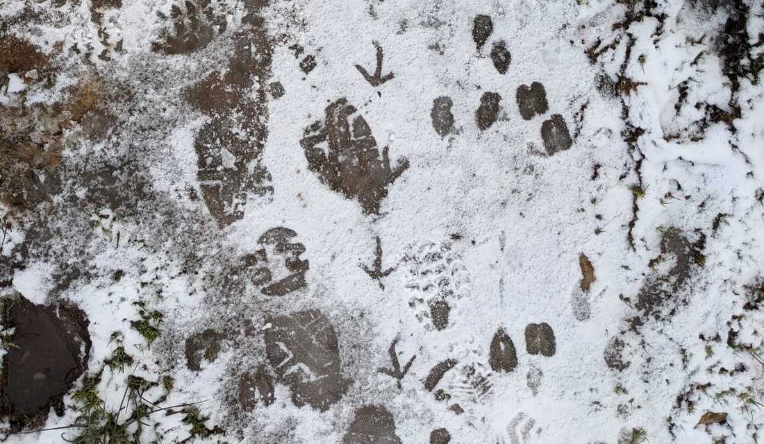
At the pool there forms a confluence of both the Dane and the footpath. We decide on the right-hand fork, but the choice is not hard because we will return along the other branch later. You may decide to turn back now and form a shorter walk, following the path under Cut-thorn Hill back to Gradbach. Leaving behind the pool we head north east, eventually meeting the head of a road and carrying on until a steep climb to Orchards Farm. As we ascend the 100m, the snow becomes increasingly thick, completely obscuring the path; but the stile provided a target from the bottom of the hill. Over the stile is a small farmhouse and behind that a track that runs around the steep sides of the hill above. We turn right and follow a hairpin bend to join the Dane Valley Way. It is at this point we turn too early, missing the path and continuing a slightly hair-raising walk along the edge of a steep, snow covered precipice to re-join the foot path. From here is a flat and comfortable walk of around 1km towards the sandstone quarries that form the apex of our walk. There is not much to do but enjoy the fresh air and, from the tracks in the snow, idly identify what creatures have passed before us on the footpath.
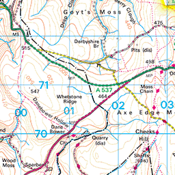
The Reeve-edge Quarries contain large, straight piles of cut sandstone that are reminiscent of the walls that border much of the Peaks lands. There are several low walls that form the foundation of long abandoned buildings. Far to the west stands the Danebower Colliery ventilation chimney, an 8-metre-tall freestone monolith that served the boiler of a surface haulage engine for the nearby shaft. We passed through to the Danebower Quarries crossing steppingstones that sit just north east of Reeve-edge and form the crest of our walk.
We stopped for hot tea and a sandwich behind the shelter of another small stone building, before continuing our journey east then south towards the monolith. We initially missed the footpath and joined the road but soon noticed our mistake and turned back. Now heading directly south follows a period of gentle walking. First atop frozen earth and then along side a small stream with eroded banks. In places wooden boardwalks have been erected because the ground has become too sodden to support the traffic. The path continues for 1km into a steep, narrow valley that after 500m opens onto the opposite side of the packhorse bridge thus returning us to the centre of our figure of eight at Panniers Pool.
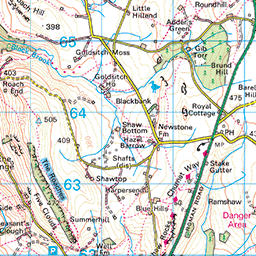
We leave the River Dane and walk west for 500m, below the steep edges of Cut-thorn hill. Shortly we pass over a road and then cross a barren moorland that leads to another, larger road. You could also veer south here towards Gradbach, but we chose to carry on. The footpath beyond the second road has wooden boardwalks to allow traversal of the sodden ground. The areas without boards form of large sheets of ice that give the feeling of walking across a thin shell above deep water. Eventually the path led us to the Leech Wood. A small but beautiful section of woodland with a narrow, winding road passing through its centre. The road is bordered by a thicket of rhododendrons that appear almost tropical under the bare branches of the trees that make up the canopy of the woods.
It does not take long for us to pass through the woods. We cross a fast road and begin climbing 100m south-east towards Gradbach. As we round the corner below the eastmost peak and obscure the view of the woods and road below, we are suddenly surrounded by whiteness. The clouds above and snow below merge on the horizon forming a scene that could be on any mountain top. The only features that ground us in Staffordshire are the low dry-stone walls and the sheep.
We begin to ascend the final 3km towards the valley floor. The snow begins to recede with altitude until we see the River Dane and behind it the car park where we began.


